GEOTECHNICAL ENGINEERING
HOUSTON
HomeIn-SituField permeability test (Lefranc/Lugeon)

Field Permeability Testing (Lefranc & Lugeon) in Houston

Evidence-based design. Reliable delivery.

LEARN MORE

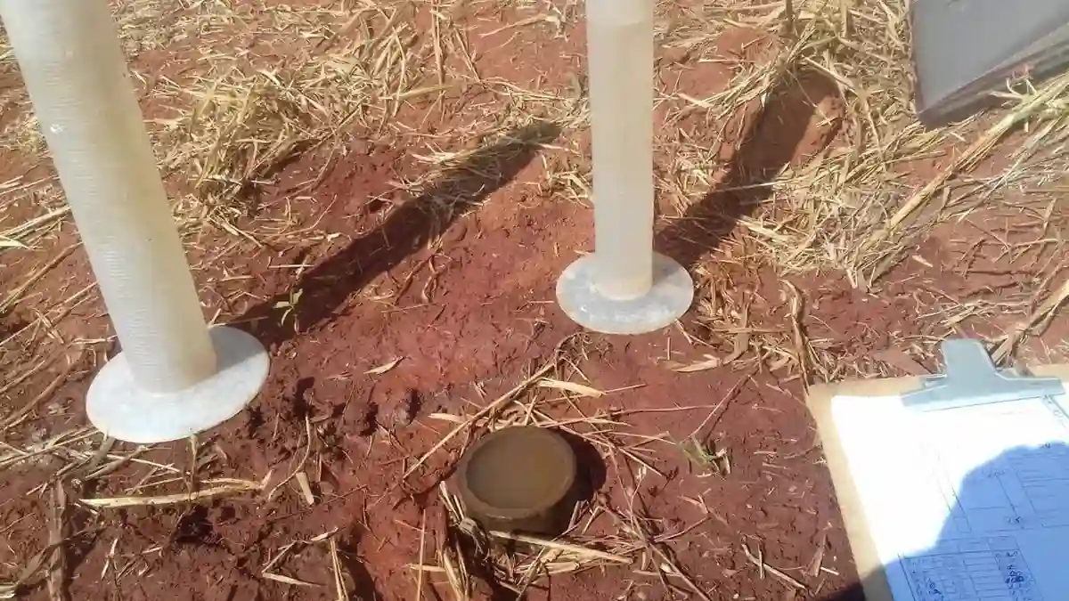
At the heart of our field permeability testing in Houston is a steel slotted screen inserted into a borehole, a graduated reservoir that maintains a steady head, and a high-precision pressure gauge tracking every psi of injection. Within the saturated clays beneath the 610 Loop, the Lefranc test yields a direct hydraulic conductivity measurement of the Beaumont Formation. For deeper, fractured zones near the Energy Corridor, we employ the Lugeon method, using a packer system to seal off certain intervals and pressurize the test section. Our lab gear follows ASTM D6391 calibration, guaranteeing that every flow reading translates accurately into a K value for your dewatering or grouting plans. In a city where pumping groundwater at one location can lead to dry, stiff clay just 200 feet away, knowing the actual in-situ permeability isn't optional—it shapes the construction budget.

Lab permeability tests on small specimens miss the sand seams and fractures that control groundwater flow in Houston's layered formations—field testing captures what the ground actually transmits.
Our service areas

Process overview

The contrast between a site near Buffalo Bayou Park and one out in Katy Prairie tells you everything about why In-Situ matters. Downtown, the Beaumont Formation clays sit below a thin cap of fill, and the permeability often hovers around 10⁻⁷ to 10⁻⁸ cm/s—low enough that an open excavation might hold water like a bathtub. But drive west to the prairie, where the Lissie Formation sands inter-finger with clay lenses, and you'll find horizontal permeability two to three orders of magnitude higher, driven by the sandy matrix. A lab remolded sample never captures that anisotropy. The Lefranc test reads it directly in the field. When we combine the results with a grain size analysis in our lab, we can calibrate the Hazen correlation to Houston-specific formations and provide a defensible permeability model for the whole site. That's the difference between a dewatering system that cycles on and off efficiently and one that runs 24/7 and still doesn't pull down the water table.
Field Permeability Testing (Lefranc & Lugeon) in Houston
Technical reference — Houston

Local context

Since the Houston Ship Channel was dredged in 1914, the city's rapid expansion has moved into low-lying floodplains and old marshlands where the subsurface hydrogeology is harsh. Misinterpreting a permeability profile hits hardest when a deep excavation near the Texas Medical Center floods because the Beaumont clay, thought to be impermeable, hides a continuous sand seam. Or a detention pond in Kingwood that cannot hold water because a perched layer drains sideways into a buried channel. Or a grouting program in a fractured Willis Formation that uses three times the estimated material because Lugeon values were guessed, not measured. Field permeability testing prevents these issues. Our team maps the true hydraulic conductivity of each stratigraphic unit so your dewatering system, cutoff wall, or foundation drain is designed for the actual ground, not the one you assumed.

Need a geotechnical assessment?

Reply within 24h.

Email: contact@geotechnicalengineering1.org

Reference standards


The relevant standards and references are: ASTM D6391-11 (Borehole Permeability via Lefranc Method), Houlsby (1976) Lugeon Test Procedure (5-cycle pressure test), and FHWA-NHI-10-016 (Geotechnical Site Characterization).

Technical data

ParameterTypical value
Test methodASTM D6391-11 (Lefranc), Houlsby procedure (Lugeon)
Test depth range3 to 60 meters below ground surface
Packer type (Lugeon)Single or double pneumatic, wireline-deployed
Pressure steps (Lugeon)5-step cycle (0.5 to 1.0 MPa max per step)
Flow measurementDigital flowmeter, ±0.5% accuracy
Data outputk (cm/s), Lugeon units, P-Q curves, transmissivity
Applicable soil/rockBeaumont clay, Lissie sands, Willis Formation clay-shale
Groundwater conditionsPerched, artesian, or water table; Houston-specific analysis

Questions and answers


How much does a field permeability test cost in Houston?

In the Houston area, a single Lefranc or Lugeon test interval typically costs between US$560 and US$1,030 per test point. The exact price depends on the borehole depth, number of test intervals, and whether the hole is already drilled and cased. A full-day testing program with multiple intervals and a signed report falls within that per-point range when packaged together.

When do we need a Lugeon test instead of a Lefranc test?

When drilling into fractured, cemented, or rock-like materials such as the clay-shales of the Willis Formation or the cemented sands found deep in Houston, the Lugeon test is the appropriate choice. A packer system isolates a specific interval and pressurizes it, providing a measure of rock mass permeability. For soil-like materials where the borehole wall remains stable enough to test without a packer, the Lefranc test is designed, particularly in the Beaumont clays.

What's the turnaround time for test results?

On site, field data including flow rates, pressure steps, and water levels are recorded digitally. The same day, the engineer reviews the P-Q curves and calculates Lugeon values or the k coefficient. The final signed report, complete with stratigraphic context and interpretation, is typically delivered within 24 to 48 hours after field work finishes.

Can you test below the water table in Houston's soft clays?

Absolutely, that is precisely where the Lefranc variable-head test excels. By bailing to lower the water level in the casing, we then measure the recovery rate as groundwater flows back into the test section. In the soft, saturated Beaumont clays common across Houston, this falling-head procedure directly measures in-situ hydraulic conductivity, avoiding the hydraulic fracturing risk associated with injection tests.

Location and service area

We serve projects across Houston and surrounding areas. More info.

View larger map